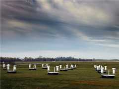
The Riegl Terrestrial Laser Scanner (TLS) is a ground-based laser scanner manufactured by Riegl Laser Measurement Systems. It provides lidar point cloud data to determine surface topography. It operates at 1550 nm and can scan at up to 122,000 points per second. It has a maximum scan range of 1.4 km and a 2 cm resolution.

Instrument Details
- Lidar
- Earth Science > Land Surface > Topography > Terrain ElevationEarth Science > Land Surface > TopographyEarth Science > Spectral/engineering > Lidar > Lidar BackscatterEarth Science > Spectral/engineering > Lidar
- Land Surface
- 122,000 Hz
- 2 cm
- 193 THz
- Currently unavailable
Currently unavailable
Currently unavailable
Riegl
Currently unavailable
Currently unavailable
 Field Site Stationary 76 Campaigns · 175 Instruments |  SnowEx 2016—2023 Colorado, Idaho, Utah, Alaska 4 Deployments · 86 Data Products
 BlueFlux 2022—2023 Southern Florida 4 Deployments · 4 Data Products
|
Filter data products from this instrument by specific campaigns, platforms, or formats.
CAMPAIGNS
PLATFORMS
FORMATS